How Are Levees Formed? A GCSE & A-Level Guide

You're probably here for one of two reasons. Either your exam is getting uncomfortably close and “levees” is one of those river landforms you keep half-remembering, or you already know the basics and want the kind of explanation that helps you write better answers.
Good. This topic is much easier once you stop treating it like a random definition and start seeing it as a chain of events. A river floods. Its speed changes. Sediment drops. A ridge builds up. That's the core of how are levees formed.
What makes levees useful in revision is that they sit right in the overlap between physical geography and human geography. They're a landform, but they're also a flood defence. That means GCSE students can use them in river process questions, and A-Level students can push further into management, evaluation, and risk.
Why Levees Are a Geographer's Best Friend
A levee is a raised bank alongside a river. Sometimes the river builds it naturally through repeated flooding. Sometimes people build it deliberately as an embankment to hold floodwater back.
That simple idea turns up everywhere in the UK curriculum. At GCSE, levees fit neatly into river landforms, flooding, and deposition. At A-Level, they become even more useful because you can discuss them as part of human attempts to manage natural systems, and then evaluate whether those attempts always work.
Two meanings students mix up
A lot of students lose marks because they treat all levees as the same thing. They aren't.
- Natural levees are built by the river itself when floodwater spills over the banks and drops sediment.
- Artificial levees are built by people, usually from earth or other reinforced materials, to increase protection.
That distinction matters. If an exam asks about formation, the marker usually wants the natural process unless the wording points clearly to flood management or embankments.
Why examiners like this topic
Levees are brilliant for geography because they link process, form, and impact in one example. You can explain the fluvial process, describe the shape of the landform, and then connect it to people living on floodplains.
They also reward proper vocabulary. Words like velocity, deposition, alluvium, floodplain, and sediment load aren't there to sound clever. They help you show cause and effect clearly.
A strong geography answer doesn't just name a landform. It explains how one process leads to the next.
If you're studying advanced river and landform topics, MasteryMind's AQA Geography course is the kind of spec-linked support that helps you practise that process-to-landform chain properly.
How Rivers Build Their Own Flood Defences
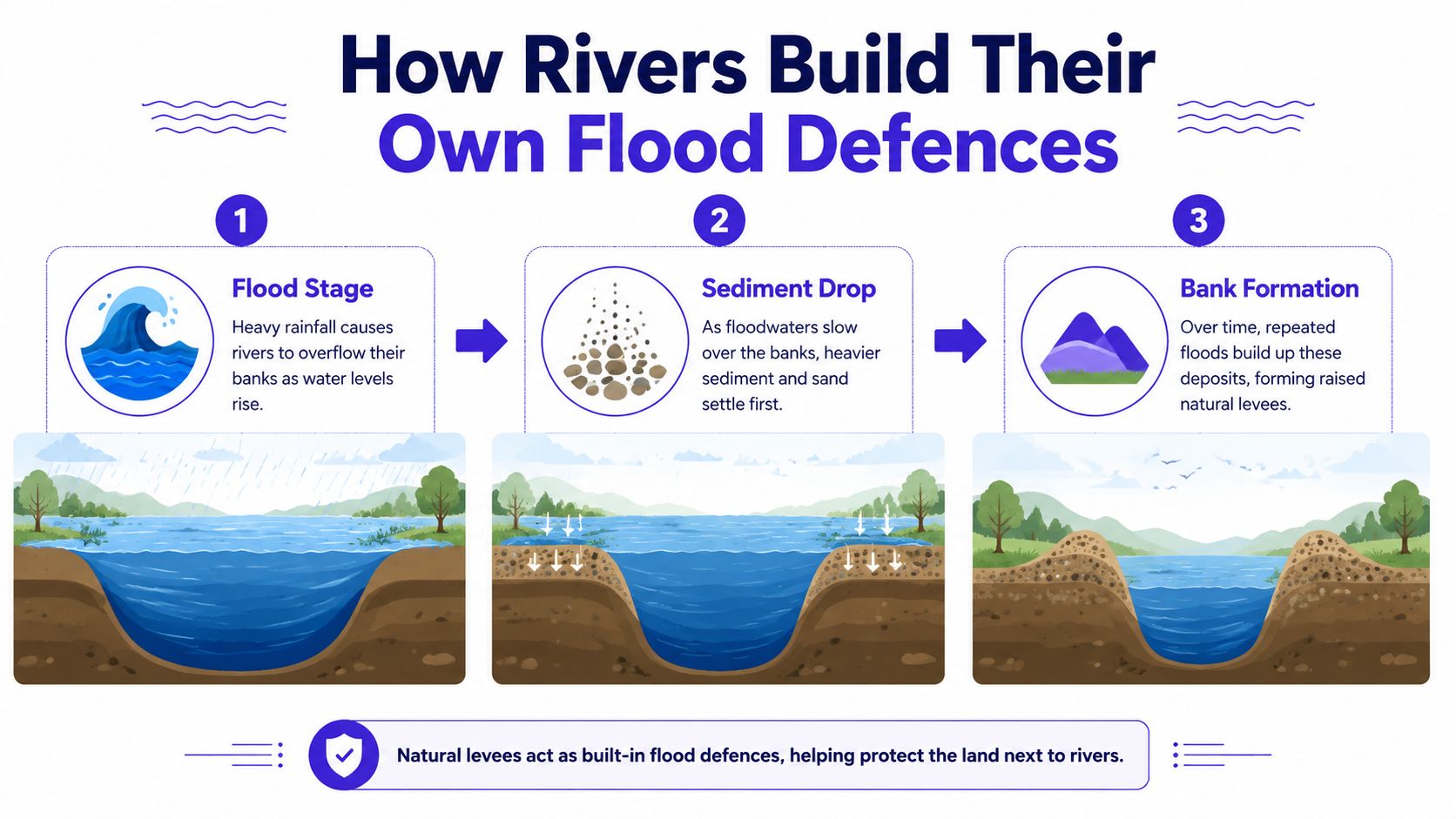
Natural levees form during overbank flooding. The river rises, spills onto the floodplain, loses energy, and drops sediment. Repeat that enough times and the banks slowly become raised.
That's the short answer. The exam answer needs a bit more precision.
Step one the river leaves its channel
In normal conditions, most of the river's water stays within its channel. During heavy rainfall or prolonged wet weather, discharge increases and the river can no longer hold all that water. It overtops its banks and spreads out across the floodplain.
As soon as the water leaves the channel, the conditions change. The floodplain has more friction from vegetation, uneven ground, and surface obstacles. Water that was moving faster in the channel suddenly slows down.
Step two velocity falls and the river loses competence
This is the part students often memorise without really understanding. A river can only carry certain material if it has enough energy. Once velocity falls, it can't transport the same load as effectively.
When a river like the Severn floods, its velocity can drop from 1.5 m/s in the channel to less than 0.2 m/s on the floodplain, which causes coarser sediments to be deposited within 5 to 10 m of the bank, while finer silts settle further away, building a levee profile 1 to 3 m high over time, as summarised in this overview of levee formation.
Step three heavy material drops first
Think of a bottle filled with water, sand, silt, and clay. Shake it, then put it down. The heavier particles settle first, and the finest material stays suspended for longer.
A flooding river does something similar. As floodwater slows, coarser material such as sand and gravel is deposited first, close to the channel edge. Finer material like silt and clay travels further out across the floodplain before settling.
That's why a levee has a typical shape:
- Closest to the river the ridge is steeper because heavier sediment is dropped quickly.
- Further away the slope is gentler because finer sediment spreads out over a wider area.
- Over many floods the river builds up a raised natural embankment on each side of the channel.
What the cross-section looks like
If you had to sketch one in an exam, don't overcomplicate it. Draw the river channel in the centre, then slightly raised ridges on both banks, then a wider, flatter floodplain beyond.
Label these features:
- River channel
- Natural levee
- Floodplain
- Coarse sediment deposited near bank
- Fine alluvium deposited further away
Practical rule: if a 4-mark or 6-mark question asks how natural levees form, make sure you include both the flood event and the sorting of sediment by size.
Why repeated flooding matters
One flood doesn't usually create a fully developed levee. The ridge builds up through repeated deposition over time. Each flood adds another thin layer, especially nearest the banks.
This is why levees are common on lower-course rivers with broad floodplains and regular flooding. They are part of a wider depositional environment, not an isolated feature.
A very common mistake is writing that levees are formed by erosion. They aren't. Erosion may shape the wider river environment, but the levee itself is a depositional landform.
Constructing Artificial Levees and Embankments
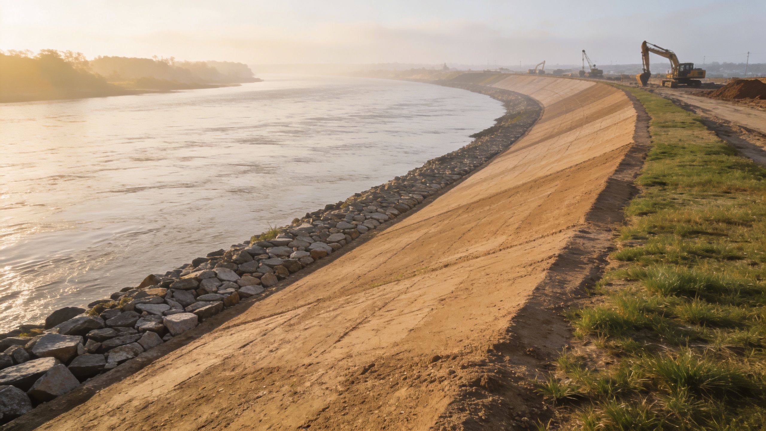
Natural levees can help contain smaller floods, but they don't always provide enough protection for farms, roads, towns, or major cities. That's where artificial levees, often called embankments, come in.
These are human-built raised barriers designed to keep water inside the channel for longer and reduce flood risk on the surrounding land.
Why people build them
The main purpose is simple. If the river's banks are made higher, the channel can hold more water before it spills out.
In flood management terms, this is a hard engineering approach. Instead of giving the river more room, people try to constrain it and protect valuable land nearby.
In the UK, this matters on a huge scale. The Environment Agency maintains 5,800 km of raised embankments, and 85% are earthen, protecting 5.2 million properties from a 1-in-100-year flood event, with much of this system upgraded after the 1953 North Sea Flood, according to the Environment Agency organisation information.
What they're usually made from
Most students picture concrete walls, but many UK embankments are mainly made of earth. That matters because “artificial levee” doesn't automatically mean “concrete”.
A typical earthen embankment often includes:
- Compacted earth: this forms the bulk of the structure and gives it mass.
- Clay-rich material: this helps reduce the movement of water through the bank.
- Protective outer layer: grass cover, stone, or other surface protection can reduce erosion.
- Shaped sides: gentler slopes help the structure stay stable.
The exact design depends on where it's built. A rural river embankment may look very different from an urban flood wall.
How the design helps
Artificial levees work because they increase the height of the river boundary. But they also need to resist pressure from floodwater.
That's why shape matters. A wide base usually makes the structure more stable than a narrow, steep one. Surface cover matters too, because flowing water can erode an exposed bank surprisingly quickly.
For students, the key thing isn't memorising every engineering detail. It's understanding the logic:
- Flood risk exists on the floodplain.
- People raise the banks to hold back more water.
- Materials and shape are chosen to reduce erosion and leakage.
- Protection improves, but risk doesn't disappear.
Natural and artificial aren't the same story
A natural levee is built gradually by the river. An artificial levee is planned and constructed by people. In exam terms, that difference changes your command words.
If the question says explain formation, focus on flood deposition.
If it says assess flood management, embankments belong in the discussion.
Don't write that artificial levees “form” in the same way as natural levees. They're built, maintained, and upgraded.
Levees in Action Famous UK and Global Examples
Examples make your answers sound like geography rather than guesswork. They show the examiner you can connect the process to real places.
Middle Thames natural levees
A strong UK example for natural levees comes from the Thames. Along the Middle Thames floodplain, geological surveys confirm natural levees averaging 1.5 m in height, formed by centuries of flood events including the Great Flood of 1883, as noted by the British Geological Survey.
That example is useful because it gives you a real river, a real floodplain, and a clear reminder that levees aren't just textbook diagrams. They exist in environments students are expected to know.
The Fens and large-scale embankments
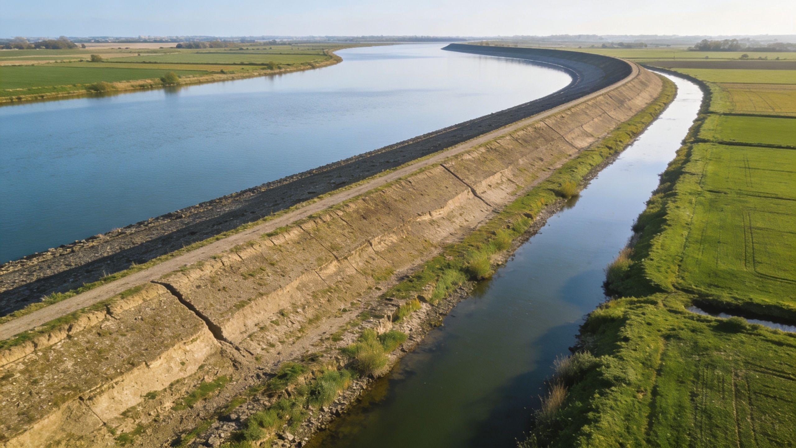
For artificial levees, the Fens in East Anglia are a classic UK case study. They're often used to show how people have tried to control water and reshape low-lying land over a long period.
The key idea here is transformation. Embankments didn't just reduce flooding. They helped turn wetland into land that people could farm, settle, and manage more intensively.
Global examples you can mention carefully
If you want to broaden an essay, global examples can help, especially at A-Level. The Mississippi in the USA is widely known for major levee systems, and the Netherlands is famous for large-scale water management. Both show the same broad point: when people live with flood risk for a long time, they often build increasingly complex defences.
You don't need a pile of numbers to use those examples well. What matters is the geographical point you make with them.
- Mississippi example: large rivers can be heavily managed with long embankment systems.
- Netherlands example: low-lying countries often rely on engineered flood defences as part of national planning.
- UK comparison: British examples are usually more effective in GCSE and A-Level answers because they match the specification more directly.
The best case study use is precise, not crowded. One well-explained UK example usually beats three vague global ones.
When Levees Fail The Risks and Dangers
Levees can reduce flood risk, but they don't make rivers safe forever. That's where stronger GCSE answers and top-band A-Level responses start to separate.
You need to know not just how levees work, but how they can go wrong.
Three main failure types
The vocabulary here matters because it gives your evaluation structure.
Overtopping
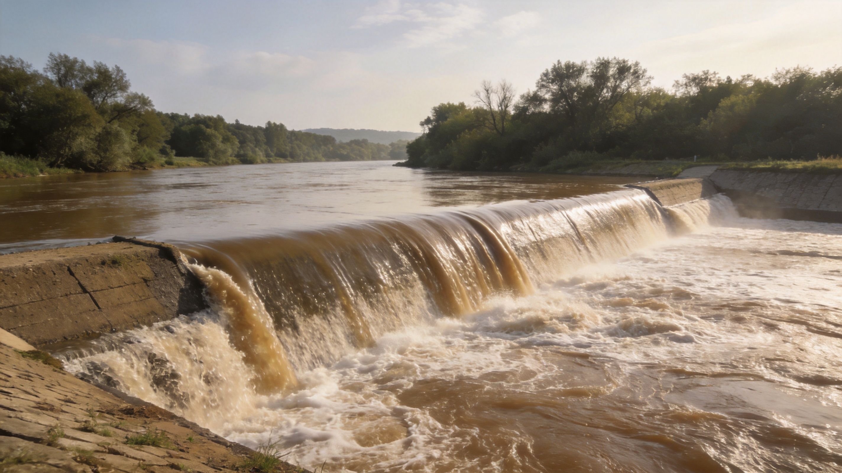
This happens when water rises above the top of the levee and flows over it. If a flood is bigger than the defence was designed for, the water exceeds the barrier.
In an exam answer, overtopping shows that every defence has a limit. A levee can lower risk, but not remove it.
Breaching
A breach means part of the levee breaks or collapses. Once a gap opens, water can rush through quickly and flood the surrounding area.
This can be especially dangerous because protected land may have more buildings and infrastructure on it. The damage can be severe if people have assumed the defence made the area fully safe.
Piping
Piping is the sneaky one students often forget. Water moves through or underneath the levee, gradually removing material and weakening the structure from within.
Because it isn't always obvious at first, piping is a strong evaluative point. A levee can look stable on the surface while hidden internal erosion is developing.
Why failure can make impacts worse
There's a wider issue here. Levees often encourage more development on floodplains because people feel protected. That can create a false sense of security.
If a major flood then overwhelms or damages the defence, more homes, roads, and businesses may be exposed than before. So the defence reduces frequent, smaller flooding but can increase vulnerability to rare, high-impact events.
Recent UK evidence adds another layer. Intensified storms can erode natural levees, reducing their effectiveness, and a 2024 UKCEH study suggests that confining rivers with levees can increase upstream flood peaks by as much as 15%, as discussed by the UK Centre for Ecology & Hydrology.
That's a very strong A-Level point because it challenges the simple idea that levees are always beneficial.
The evaluation point examiners want
At lower levels, students often write “levees stop floods”. That's too absolute.
A better judgement sounds more like this:
- They reduce risk in many situations.
- They can fail through overtopping, breaching, or piping.
- They may transfer risk elsewhere, especially upstream or to areas that become more dependent on protection.
If you're revising flood risk and hazard evaluation more broadly, this A-Level hazards revision page is useful for sharpening that judgement style.
Here's a short visual explainer to reinforce the main failure ideas:
How to turn this into marks
For GCSE, use risk points briefly.
For A-Level, evaluate.
Exam insight: the best evaluation doesn't say a strategy is “good” or “bad”. It explains who benefits, where the risk goes, and under what conditions the strategy may fail.
Ace Your Exam Your Levee Revision Summary
If you want one clean memory line, use this:
Natural levees form when a river floods, slows on the floodplain, and deposits heavier sediment near the banks while finer material settles further away.
That sentence alone can anchor a lot of your answer.
Quick revision bullets
- Natural levees: built by repeated flood deposition along river banks.
- Key process: floodwater leaves the channel, loses velocity, and drops sediment.
- Sediment sorting: coarser material is deposited first near the bank, finer alluvium further away.
- Artificial levees: human-built embankments designed to reduce flood risk.
- Main weakness: they can fail, and they can also shift or concentrate flood risk.
Natural vs. Artificial Levees at a Glance
| Feature | Natural Levee | Artificial Levee |
|---|---|---|
| How it develops | Built gradually by repeated river flooding and deposition | Constructed by people as a flood defence |
| Main material | Alluvium such as sand, silt, clay, and sometimes gravel | Usually earth and other engineered materials |
| Location | Along river banks on floodplains | Along rivers or coasts where protection is needed |
| Purpose | Forms as a natural landform | Built to reduce flood risk to land and property |
| Exam use | River landform and deposition process | Flood management and evaluation |
Sentence starters that actually help
Examiner's tip: start with process. “Natural levees form during overbank flooding when the river loses velocity on the floodplain and deposits sediment.”
“The heavier load is dropped first near the channel, while finer sediment is carried further away, producing a raised ridge beside the river.”
“However, although levees reduce flood risk, they can fail through overtopping, breaching, or piping and may increase risk elsewhere.”
Those are useful because they build explanation and evaluation naturally.
What to do for different question types
For a 4-mark explain question
Keep it tight. Mention flooding, reduced velocity, deposition of coarse then fine sediment, and raised banks.
For a 6-mark or 9-mark process question
Add sequence and vocabulary. Use overbank flow, friction, deposition, alluvium, and floodplain.
For a 12-mark or 20-mark A-Level evaluate question
Bring in both sides:
- natural benefits
- artificial flood protection
- failure risk
- false security
- upstream consequences
If you need realistic practice questions to test that under timed conditions, A-Level Past papers are one of the best ways to see how levees appear in actual exam wording.
Final mistakes to avoid
- Don't say levees are formed by erosion.
- Don't confuse natural levees with artificial embankments.
- Don't write that levees “prevent flooding” with no qualification.
- Don't forget that repeated floods build the landform over time.
If you can explain the chain clearly, use one UK example, and add one evaluative point, you're already ahead of a lot of students.
If you want revision that feels like actual exam practice, MasteryMind gives you spec-aligned practice for GCSE and A-Level Geography, with exam-style questions, instant feedback, and support that matches AQA, Edexcel, OCR, and WJEC. It's a smart way to turn “I kind of get levees” into “I can write this under pressure.”
Ready to master this topic?
Practise with quizzes, blurt exercises and exam questions on MasteryMind.
7 days Premium · Then free forever · No card, no charge