AQA · A-Level · Geography
Course version: 7037 · Version from Sept 2018
Cartographic skills: Atlas maps.
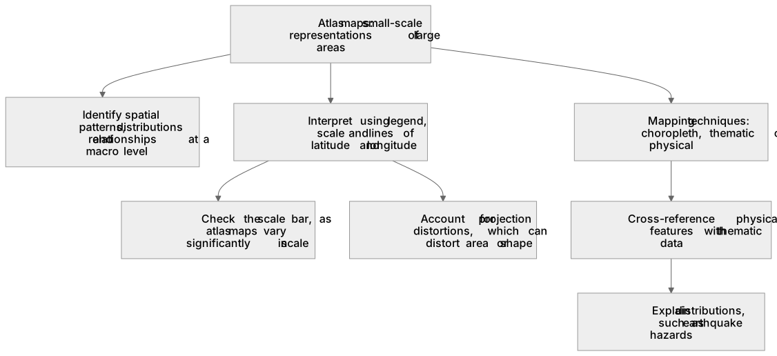
Atlas maps are small-scale representations of large areas, such as countries or continents, used to identify spatial patterns, distributions, and relationships on a macro level.
Checked against the AQA 7037 specification (opens in a new tab) on .
- Point 1 of 5
- 3 key terms
Study notes
From the checked teaching notes for this specification point.
The idea
Atlas maps are small-scale representations of large areas, such as countries or continents, used to identify spatial patterns, distributions, and relationships on a macro level. They often employ choropleth, thematic, or physical mapping techniques to display data like population density, climate zones, or topography. For example, when analysing a global atlas map of tectonic plate boundaries, you should cross-reference the physical features with thematic data to explain the distribution of earthquake hazards. Understanding the projection used is also vital, as some distort area or shape, impacting spatial analysis.
What earns the marks
- Accurately extract and interpret data from thematic atlas maps using the provided key or legend.
- Identify and describe macro-scale spatial patterns, such as global population distribution or biome locations.
- Use lines of latitude and longitude to provide precise geographical locations for observed features.
- Synthesise information from multiple atlas maps, such as physical and political maps, to explain geographical relationships.
Common mistakes and how to put them right
Ignoring the map scale when estimating distances.
Put it right: Check the specific scale bar as atlas maps vary significantly in scale.
Failing to account for map projection distortions.
Put it right: Projections like Mercator exaggerate the size of landmasses near the poles.
Describing patterns vaguely without using specific geographical terminology.
Put it right: Use compass directions, continents, and coordinates to anchor descriptions.
Exam tips
- Always read the title and key of the atlas map first to understand exactly what variable is being shown.
- When asked to describe a distribution, look for anomalies or outliers as well as the general pattern.
- Cross-reference physical atlas maps with thematic ones to find explanatory factors for human geography patterns.
Try the lesson
The start of the Cartographic skills: Atlas maps. lesson, made from checked teaching notes for this specification point.
Have a go first
Which of the following is a defining characteristic of most general reference atlas maps compared to Ordnance Survey Explorer maps?
Listen
Atlas maps are small-scale representations of large areas, such as countries or continents, used to identify spatial patterns, distributions, and relationships on a macro level. They often employ choropleth, thematic, or physical mapping techniques to display data like population density, climate zones, or topography. For example, when analysing a global atlas map of tectonic plate boundaries, you should cross-reference the physical features with thematic data to explain the distribution of earthquake hazards. Understanding the projection used is also vital, as some distort area or shape, impacting spatial analysis. A strong answer earns marks for these points. Accurately extract and interpret data from thematic atlas maps using the provided key or legend. Identify and describe macro-scale spatial patterns, such as global population distribution or biome locations. Use lines of latitude and longitude to provide precise geographical locations for observed features. Synthesise information from multiple atlas maps, such as physical and political maps, to explain geographical relationships. Exam tip: Always read the title and key of the atlas map first to understand exactly what variable is being shown.
See it
Key words
Say what each word means before you turn the card.
Spatial distribution
Try answering aloud or in your head before turning the card.
Scale
Try answering aloud or in your head before turning the card.
Geographical relationships
Try answering aloud or in your head before turning the card.
See every definition
- Spatial distribution
- The arrangement of features or data shown on a map, which atlas maps are used to identify at a macro level.
- Scale
- A property of atlas maps, which are small-scale representations of large areas such as countries or continents, and which must be checked as atlas maps vary significantly.
- Geographical relationships
- Links between features that can be explained by synthesising information from multiple atlas maps, such as physical and political maps.
Label the diagram
Some boxes have lost their names. Pick the right name for each number.
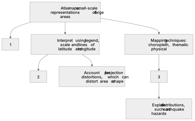
1Box 1
2Box 2
3Box 3
There is more to this lesson
The full lesson goes on to check your understanding and help you earn the marks. Create a free account to carry on, with your progress saved.
A week of Premium from your first lesson · Then the free plan continues · No card, no charge
Test your understanding of Cartographic skills: Atlas maps.
Active recall beats re-reading. Take an instant quiz now to test what you’ve learned and lock it into long-term memory.
A week of Premium from your first lesson · Then the free plan continues · No card, no charge