AQA · A-Level · Geography
Course version: 7037 · Version from Sept 2018
The global distribution of past and present cold environments (polar,…
Full specification wording
The nature and distribution of cold environments: The global distribution of past and present cold environments (polar, alpine, glacial and periglacial) and of areas affected by the Pleistocene glaciations.
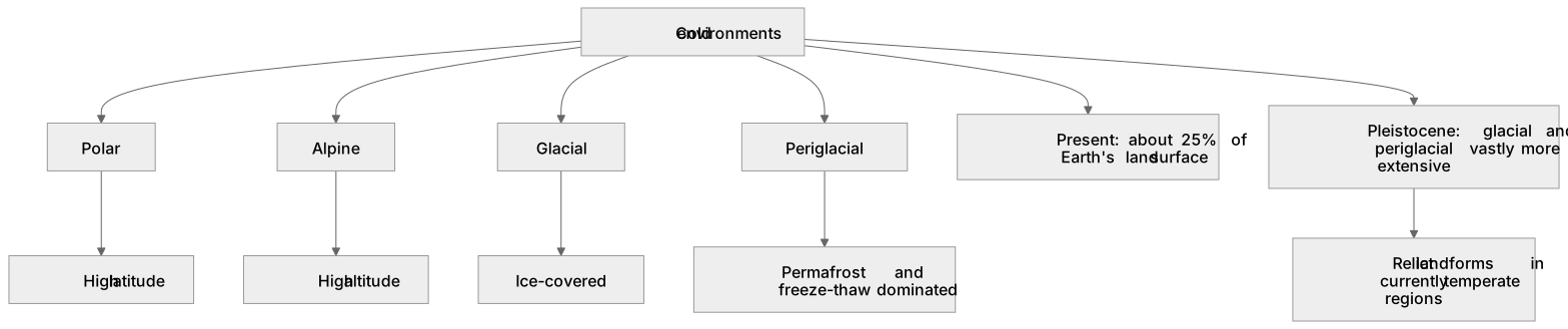
Cold environments are categorised into polar (high latitude, e.g., Antarctica), alpine (high altitude, e.g., the Himalayas), glacial (ice-covered), and periglacial (edge of ice,…
Checked against the AQA 7037 specification (opens in a new tab) on .
- Point 3 of 3
- 3 key terms
Study notes
From the checked teaching notes for this specification point.
The idea
Cold environments are categorised into polar (high latitude, e.g., Antarctica), alpine (high altitude, e.g., the Himalayas), glacial (ice-covered), and periglacial (edge of ice, permafrost-dominated, e.g., Northern Siberia). Presently, these cover about 25% of the Earth's land surface. However, during the Pleistocene epoch (2.58 million to 11,700 years ago), glacial and periglacial environments were vastly more extensive. The Laurentide Ice Sheet covered much of North America, while the Devensian glaciation covered the UK down to the Bristol Channel. Understanding this past distribution is crucial because relict landforms in currently temperate regions (like the UK's Lake District) were shaped by these historical Pleistocene glaciations.
What earns the marks
- Define and locate present polar (high latitude, typically >66°N/S) and alpine (high altitude) environments.
- Distinguish between glacial (actively ice-covered) and periglacial (permafrost, freeze-thaw dominated) environments.
- Identify the maximum extent of Pleistocene glaciations, noting coverage across North America (Laurentide) and Northern Europe (Fennoscandian).
- Explain how past Pleistocene distributions explain relict glacial and periglacial landforms in modern temperate zones.
Common mistakes and how to put them right
Confusing polar and alpine environments.
Put it right by noting polar is determined by high latitude whereas alpine is determined by high altitude regardless of latitude.
Assuming periglacial environments are always currently adjacent to glaciers.
Put it right by noting they are defined by permafrost and freeze-thaw processes, often far from active ice today.
Believing the Pleistocene was a single continuous ice age.
Put it right by explaining it consisted of multiple glacial advances (stadials) and warmer retreats (interstadials).
Exam tips
- Use specific geographical examples, such as the Devensian ice limit in the UK, when discussing Pleistocene extent.
- When describing distributions, use latitude and continental references rather than vague terms like 'up north'.
- Link the past distribution of ice sheets to the presence of relict landforms in currently temperate areas.
Try the lesson
The start of the The nature and distribution of cold environments: The global distribution of past and present cold environments (polar, alpine, glacial and periglacial) and of areas affected by the Pleistocene glaciations. lesson, made from checked teaching notes for this specification point.
Have a go first
Which of the following best describes the current global distribution of periglacial environments?
Listen
Cold environments are categorised into polar (high latitude, e.g., Antarctica), alpine (high altitude, e.g., the Himalayas), glacial (ice-covered), and periglacial (edge of ice, permafrost-dominated, e.g., Northern Siberia). Presently, these cover about 25% of the Earth's land surface. However, during the Pleistocene epoch (2.58 million to 11,700 years ago), glacial and periglacial environments were vastly more extensive. The Laurentide Ice Sheet covered much of North America, while the Devensian glaciation covered the UK down to the Bristol Channel. Understanding this past distribution is crucial because relict landforms in currently temperate regions (like the UK's Lake District) were shaped by these historical Pleistocene glaciations. A strong answer earns marks for these points. Define and locate present polar (high latitude, typically >66°N/S) and alpine (high altitude) environments. Distinguish between glacial (actively ice-covered) and periglacial (permafrost, freeze-thaw dominated) environments. Identify the maximum extent of Pleistocene glaciations, noting coverage across North America (Laurentide) and Northern Europe (Fennoscandian). Explain how past Pleistocene distributions explain relict glacial and periglacial landforms in modern temperate zones. A common slip: Confusing polar and alpine environments. Instead, noting polar is determined by high latitude whereas alpine is determined by high altitude regardless of latitude. Exam tip: Use specific geographical examples, such as the Devensian ice limit in the UK, when discussing Pleistocene extent.
See it
Key words
Say what each word means before you turn the card.
Relict landscapes
Try answering aloud or in your head before turning the card.
Polar
Try answering aloud or in your head before turning the card.
Alpine
Try answering aloud or in your head before turning the card.
See every definition
- Relict landscapes
- Landforms in currently temperate regions that were shaped by historical Pleistocene glaciations.
- Polar
- A cold environment determined by high latitude.
- Alpine
- A cold environment determined by high altitude regardless of latitude.
Label the diagram
Some boxes have lost their names. Pick the right name for each number.
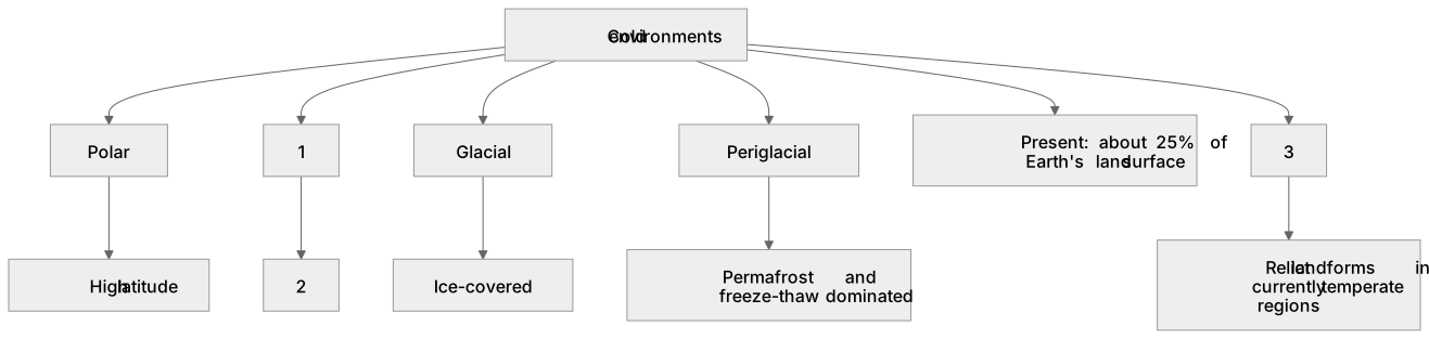
1Box 1
2Box 2
3Box 3
There is more to this lesson
The full lesson goes on to check your understanding and help you earn the marks. Create a free account to carry on, with your progress saved.
A week of Premium from your first lesson · Then the free plan continues · No card, no charge
Test your understanding of The nature and distribution of cold environments: The global distribution of past and present cold environments (polar, alpine, glacial and periglacial) and of areas affected by the Pleistocene glaciations.
Active recall beats re-reading. Take an instant quiz now to test what you’ve learned and lock it into long-term memory.
A week of Premium from your first lesson · Then the free plan continues · No card, no charge