AQA · A-Level · Geography
Course version: 7037 · Version from Sept 2018
Core skills: Use of overlays, both physical and electronic.
Overlays are a fundamental geographical skill used to identify spatial relationships and patterns by superimposing different datasets.
Checked against the AQA 7037 specification (opens in a new tab) on .
- Point 2 of 4
- 4 key terms
Study notes
From the checked teaching notes for this specification point.
The idea
Overlays are a fundamental geographical skill used to identify spatial relationships and patterns by superimposing different datasets. Physical overlays involve placing transparent sheets, such as tracing paper or acetate, over base maps (like an OS map) to manually draw and compare variables, such as flood risk zones over settlement patterns. Electronic overlays utilise Geographic Information Systems (GIS), such as ArcGIS or Google Earth, to digitally stack multiple data layers. This electronic method allows geographers to toggle layers on and off, adjust transparency, and analyse complex spatial correlations rapidly, such as overlaying census deprivation data onto urban land-use maps to evaluate socio-economic inequalities.
What earns the marks
- Ability to interpret spatial relationships by comparing two or more overlaid datasets.
- Understanding the advantages of electronic GIS overlays, such as the ability to manipulate layer transparency and scale dynamically.
- Application of physical overlays using transparent media to extract specific thematic information from a complex base map.
- Evaluation of the limitations of overlays, such as data obsolescence or the risk of obscuring underlying base map features.
Common mistakes and how to put them right
Assuming electronic overlays are always perfectly aligned.
Put it right: Recognise that different GIS layers may use different coordinate systems or scales, requiring careful georeferencing before analysis.
Overcrowding physical overlays with too much information.
Put it right: Select only one or two specific variables per transparent layer to ensure patterns remain visible and interpretable.
Confusing correlation with causation when analysing overlaid data.
Put it right: State that while overlays show spatial association (for example, crime rates and street lighting), they do not prove one causes the other.
Exam tips
- When evaluating GIS, explicitly mention the ability to toggle layers and adjust transparency as a key advantage over physical overlays.
- Use specific examples of datasets that could be overlaid, such as topography and flood risk, to demonstrate practical geographical application.
- Remember to check the dates of different overlaid layers, as comparing historical base maps with modern thematic data can lead to invalid conclusions.
Try the lesson
The start of the Core skills: Use of overlays, both physical and electronic. lesson, made from checked teaching notes for this specification point.
Have a go first
Which of the following best describes the primary purpose of using map overlays in geographical analysis?
Listen
Overlays are a fundamental geographical skill used to identify spatial relationships and patterns by superimposing different datasets. Physical overlays involve placing transparent sheets, such as tracing paper or acetate, over base maps (like an OS map) to manually draw and compare variables, such as flood risk zones over settlement patterns. Electronic overlays utilise Geographic Information Systems (GIS), such as ArcGIS or Google Earth, to digitally stack multiple data layers. This electronic method allows geographers to toggle layers on and off, adjust transparency, and analyse complex spatial correlations rapidly, such as overlaying census deprivation data onto urban land-use maps to evaluate socio-economic inequalities. A strong answer earns marks for these points. Ability to interpret spatial relationships by comparing two or more overlaid datasets. Understanding the advantages of electronic GIS overlays, such as the ability to manipulate layer transparency and scale dynamically. Application of physical overlays using transparent media to extract specific thematic information from a complex base map. Evaluation of the limitations of overlays, such as data obsolescence or the risk of obscuring underlying base map features. A common slip: Assuming electronic overlays are always perfectly aligned. Instead, Recognise that different GIS layers may use different coordinate systems or scales, requiring careful georeferencing before analysis. Exam tip: When evaluating GIS, explicitly mention the ability to toggle layers and adjust transparency as a key advantage over physical overlays.
See it
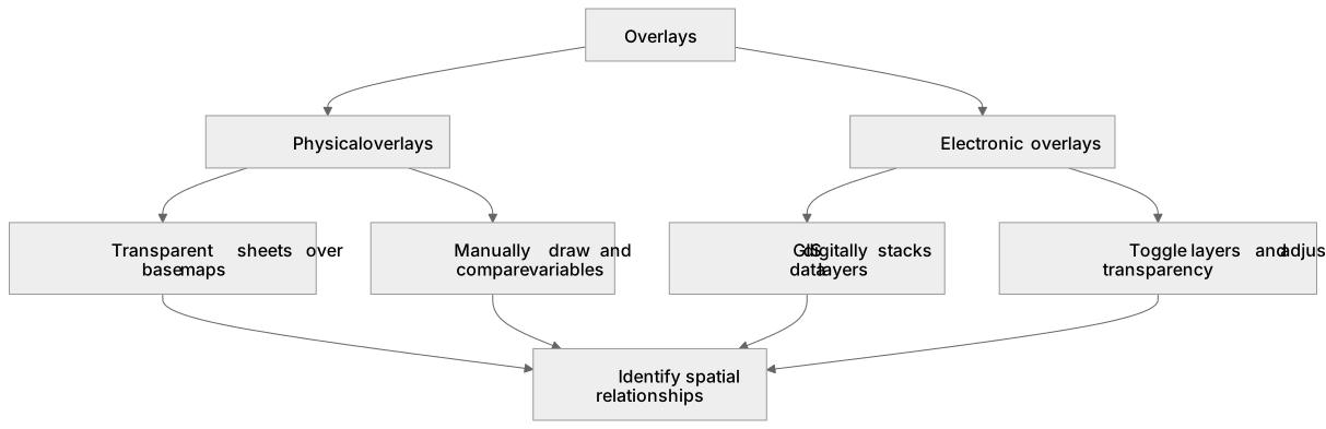
Key words
Say what each word means before you turn the card.
Physical overlays
Try answering aloud or in your head before turning the card.
Electronic overlays
Try answering aloud or in your head before turning the card.
Geographic Information Systems (GIS)
Try answering aloud or in your head before turning the card.
Spatial correlations
Try answering aloud or in your head before turning the card.
See every definition
- Physical overlays
- Placing transparent sheets, such as tracing paper or acetate, over base maps to manually draw and compare variables.
- Electronic overlays
- Digitally stacking multiple data layers using Geographic Information Systems to analyse complex spatial correlations rapidly.
- Geographic Information Systems (GIS)
- Systems such as ArcGIS or Google Earth that allow layers to be toggled on and off and transparency to be adjusted.
- Spatial correlations
- Relationships identified by overlaying datasets, such as census deprivation data onto urban land-use maps to evaluate socio-economic inequalities.
Label the diagram
Some boxes have lost their names. Pick the right name for each number.
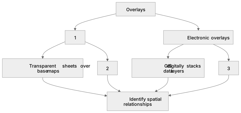
1Box 1
2Box 2
3Box 3
There is more to this lesson
The full lesson goes on to check your understanding and help you earn the marks. Create a free account to carry on, with your progress saved.
A week of Premium from your first lesson · Then the free plan continues · No card, no charge
Test your understanding of Core skills: Use of overlays, both physical and electronic.
Active recall beats re-reading. Take an instant quiz now to test what you’ve learned and lock it into long-term memory.
A week of Premium from your first lesson · Then the free plan continues · No card, no charge