AQA · A-Level · Geography
Course version: 7037 · Version from Sept 2018
ICT skills: Use of remotely sensed data (as described above in Core skills).
Remotely sensed data involves gathering information about the Earth's surface from a distance, typically using satellites, aircraft, or drones.
Checked against the AQA 7037 specification (opens in a new tab) on .
- Point 1 of 4
- 2 key terms
Study notes
From the checked teaching notes for this specification point.
The idea
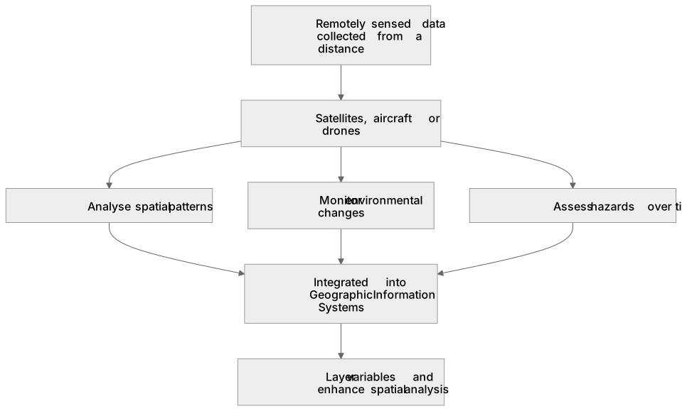
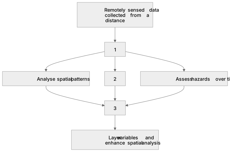
Remotely sensed data involves gathering information about the Earth's surface from a distance, typically using satellites, aircraft, or drones. Geographers use this data to analyse spatial patterns, monitor environmental changes, and assess hazards over time. For example, satellite imagery can track the retreat of glacial ice, measure rates of deforestation in the Amazon, or map flood extents following a severe storm. By comparing historical and contemporary images, students can quantify land-use changes and evaluate the impacts of human activity or physical processes. This data is often integrated into Geographic Information Systems to layer variables and enhance spatial analysis.
What earns the marks
- Identify specific geographical features or changes over time using satellite or aerial imagery.
- Explain how remotely sensed data provides a broader spatial scale than ground-level fieldwork.
- Evaluate the limitations of remotely sensed data, such as cloud cover obscuring satellite images or the cost of high-resolution drone surveys.
- Describe how remotely sensed data can be integrated with Geographic Information Systems to analyse relationships between different spatial variables.
Common mistakes and how to put them right
Confusing remote sensing with Geographic Information Systems.
Put it right: Remote sensing is the collection of data from a distance, whereas Geographic Information Systems are the software used to store, analyse, and display that data.
Overlooking scale and resolution; students often fail to note that low-resolution imagery cannot be used to identify small-scale local features like individual buildings.
Exam tips
- When asked to evaluate data sources, contrast the broad spatial coverage of remote sensing with the detailed, site-specific nature of primary fieldwork.
- Use specific examples of remotely sensed data, such as Landsat imagery or LiDAR, to demonstrate a strong understanding of geographical techniques.
- Always consider the temporal aspect; mention how comparing images from different dates allows for the calculation of rates of change.
Try the lesson
The start of the ICT skills: Use of remotely sensed data (as described above in Core skills). lesson, made from checked teaching notes for this specification point.
Have a go first
Which of the following is an example of remotely sensed data commonly used in geographical investigations?
Listen
Remotely sensed data involves gathering information about the Earth's surface from a distance, typically using satellites, aircraft, or drones. Geographers use this data to analyse spatial patterns, monitor environmental changes, and assess hazards over time. For example, satellite imagery can track the retreat of glacial ice, measure rates of deforestation in the Amazon, or map flood extents following a severe storm. By comparing historical and contemporary images, students can quantify land-use changes and evaluate the impacts of human activity or physical processes. This data is often integrated into Geographic Information Systems to layer variables and enhance spatial analysis. A strong answer earns marks for these points. Identify specific geographical features or changes over time using satellite or aerial imagery. Explain how remotely sensed data provides a broader spatial scale than ground-level fieldwork. Evaluate the limitations of remotely sensed data, such as cloud cover obscuring satellite images or the cost of high-resolution drone surveys. Describe how remotely sensed data can be integrated with Geographic Information Systems to analyse relationships between different spatial variables. Exam tip: When asked to evaluate data sources, contrast the broad spatial coverage of remote sensing with the detailed, site-specific nature of primary fieldwork.
See it
Key words
Say what each word means before you turn the card.
Remotely sensed data
Try answering aloud or in your head before turning the card.
Geographic Information Systems
Try answering aloud or in your head before turning the card.
See every definition
- Remotely sensed data
- Information about the Earth's surface gathered from a distance, typically using satellites, aircraft, or drones.
- Geographic Information Systems
- Software used to store, analyse, and display data, into which remotely sensed data is often integrated to layer variables and enhance spatial analysis.
Label the diagram
Some boxes have lost their names. Pick the right name for each number.
1Box 1
2Box 2
3Box 3
There is more to this lesson
The full lesson goes on to check your understanding and help you earn the marks. Create a free account to carry on, with your progress saved.
A week of Premium from your first lesson · Then the free plan continues · No card, no charge
Test your understanding of ICT skills: Use of remotely sensed data (as described above in Core skills).
Active recall beats re-reading. Take an instant quiz now to test what you’ve learned and lock it into long-term memory.
A week of Premium from your first lesson · Then the free plan continues · No card, no charge