OCR · GCSE · Geography
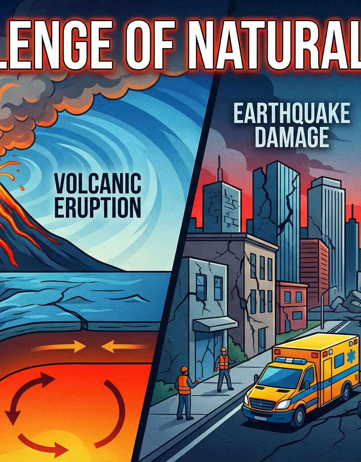
The Challenge of Natural Hazards
This study guide for OCR GCSE Geography delves into the Challenge of Natural Hazards, focusing on tectonic processes and their differential impacts. It provides a rigorous, exam-focused breakdown of plate tectonics, volcanic and seismic events, and the critical human factors that shape disaster outcomes, equipping candidates with the knowledge to excel.
- 5 min read
- 3 worked examples
- 5 practice questions
- 6 key terms
Study Notes
Overview
This topic explores the physical processes that drive natural hazards and the complex ways they interact with human populations. For the OCR exam, candidates must demonstrate a clear understanding of the mechanics behind tectonic and atmospheric hazards, analyse their impacts, and critically evaluate management strategies. A key focus is the contrast in vulnerability and resilience between Higher Income Countries (HICs) and Lower Income Countries (LICs). Examiners expect precise use of geographical terminology, the application of named case studies with specific data, and the ability to assess the effectiveness of different responses. Credit is awarded for moving beyond simple description to a more analytical and evaluative approach, linking physical geography to human factors like governance, wealth, and technology.

Key Concepts: Tectonic Hazards
Global Distribution of Tectonic Hazards
What it is: The global pattern of earthquakes and volcanoes is not random. They are concentrated in narrow belts along tectonic plate boundaries. The most significant is the Pacific 'Ring of Fire', an area around the Pacific Ocean where over 75% of the world's volcanoes and 90% of its earthquakes occur.
Why it matters: In the exam, candidates must be able to describe this distribution using specific geographical language, including compass directions and naming the major plates (e.g., Pacific, Nazca, Eurasian, African). Marks are awarded for linking the location of hazards directly to the type of plate boundary.
Specific Knowledge: Pacific Ring of Fire, Mid-Atlantic Ridge, Alpine-Himalayan Belt.
Plate Boundary Mechanics
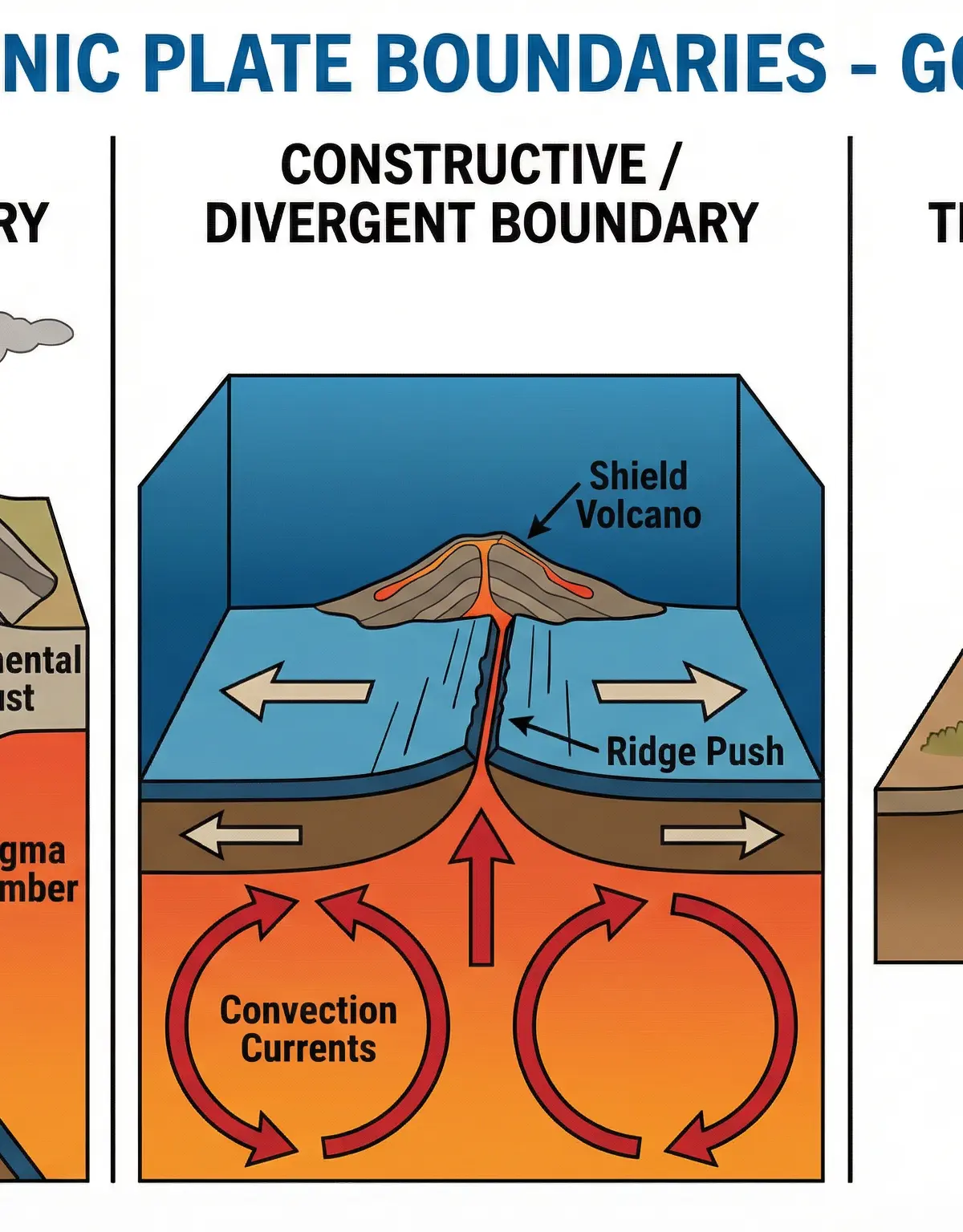
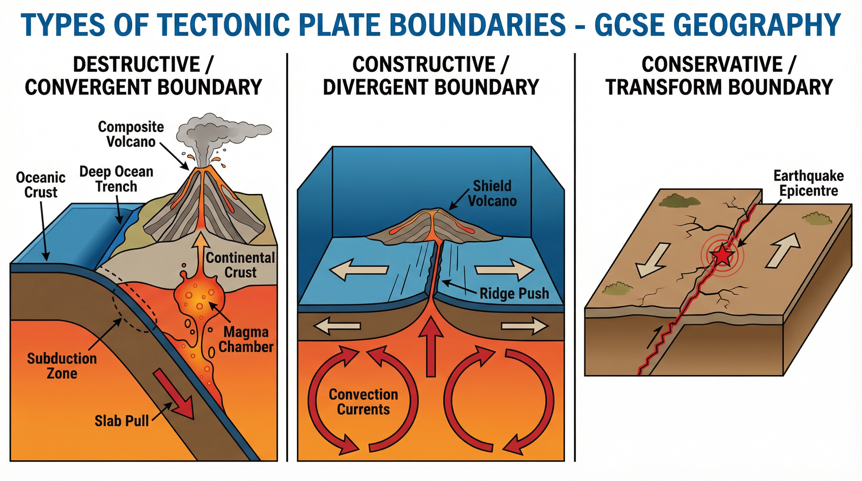
What it is: Tectonic plates move due to three primary mechanisms: convection currents in the mantle, ridge push at constructive margins, and slab pull at destructive margins. The interaction at these boundaries creates distinct landforms and hazards.
- Destructive (Convergent): Denser oceanic crust is forced under (subducts) lighter continental crust. This process creates deep ocean trenches, powerful earthquakes, and explosive composite volcanoes. Example: The Nazca plate subducting under the South American plate.
- Constructive (Divergent): Two plates move apart, allowing magma to rise and form new crust. This creates shield volcanoes and less powerful earthquakes. Example: The Mid-Atlantic Ridge.
- Conservative (Transform): Two plates slide past each other. No crust is created or destroyed, and there are no volcanoes, but the friction can cause powerful, shallow-focus earthquakes. Example: The San Andreas Fault in California.
Why it matters: Explaining how these mechanisms cause specific hazards is a core skill. Candidates must differentiate between the properties of oceanic (dense, thin, basalt) and continental (less dense, thick, granite) crust to explain subduction. Linking the depth of the earthquake focus to surface intensity is also critical for high marks.
Contrasting Impacts: LICs vs HICs
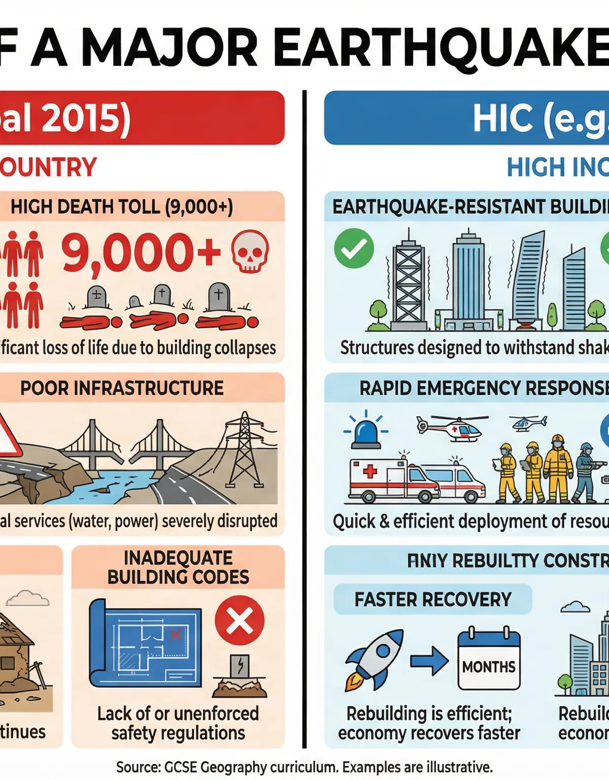
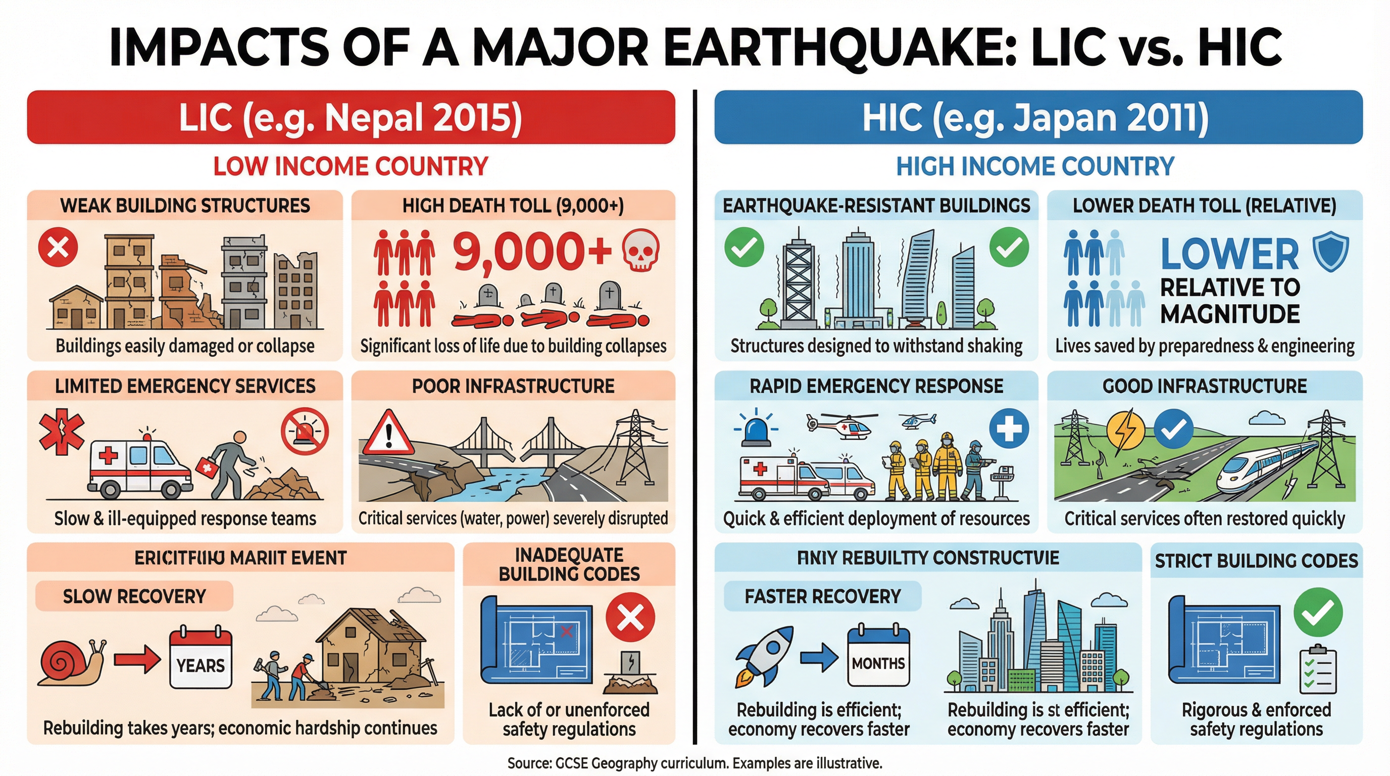
What it is: The human impact of a natural hazard is not determined by its physical magnitude alone. A country's wealth and level of development are crucial factors.
- LICs (e.g., Nepal Earthquake, 2015): Tend to suffer higher death tolls due to poorly constructed buildings, limited emergency services, and inadequate infrastructure. Economic costs can be devastating relative to GDP, and long-term recovery is slow.
- HICs (e.g., Japan Earthquake and Tsunami, 2011): Tend to have lower death tolls due to strict building codes, advanced early warning systems, and well-funded emergency services. However, economic costs can be vast in absolute terms due to damage to expensive infrastructure.
Why it matters: This is a central theme. Examiners require candidates to use named case studies to compare and explain these differences, attributing them to specific factors like governance, building codes, and disaster preparedness, not just generic statements about wealth.
Visual Resources
2 diagrams and illustrations
Interactive Diagrams
1 interactive diagram to visualise key concepts
Conceptual Flow Outline
Flowchart showing the three main types of tectonic hazard management: Prediction, Protection, and Preparation.
Worked Examples
3 worked examples — open one to explore the question and available guidance.
Practice Questions
Test your understanding — click to reveal model answers
Explain the formation of a composite volcano. (4 marks)
Hint: Think about the plate boundary, the type of crust, and the properties of the lava.
Compare the primary and secondary impacts of a named earthquake. (6 marks)
Hint: Primary impacts happen immediately. Secondary impacts happen as a result of the primary ones.
Describe the global distribution of earthquakes. (3 marks)
Hint: Think about plate boundaries and name specific belts or regions.
Explain two reasons why people continue to live in areas at risk from tectonic hazards. (4 marks)
Hint: Think about both economic and social reasons.
Assess the view that the impacts of tectonic hazards are more severe in LICs than in HICs. (8 marks)
Hint: Use contrasting case studies. Remember to assess — weigh up the evidence and reach a conclusion.