Pearson Edexcel · GCSE · Geography
Distinctive glaciated upland landscapes are the outcome of the interaction between physical and human processes
This study guide explores how the UK's dramatic glaciated upland landscapes are shaped by the interaction of physical processes and human activities. Understanding these relict landscapes is crucial for grasping how past ice ages and current human pressures combine to form the geography we see today.
- 6 min read
- 3 worked examples
- 2 practice questions
- 6 key terms
Study Notes
Overview
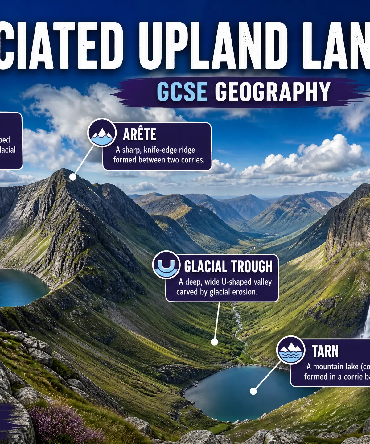
Glaciated upland landscapes in the UK—such as the Lake District, Snowdonia, and the Scottish Highlands—are striking environments shaped by the interaction of physical and human processes. During the last Ice Age, massive glaciers carved these landscapes, creating distinctive erosion and deposition landforms. Today, these are considered 'relict landscapes' because the glaciers are gone, but the landforms remain and are continuously modified by post-glacial weathering (like freeze-thaw) and mass movement. Furthermore, human activities such as farming, forestry, settlement, water storage, and tourism heavily impact these areas. Examiners expect candidates to clearly differentiate between glacial processes (which happened in the past) and weathering processes (happening today), and to explicitly link human activities to their impact on the physical landscape.
Audio Revision
Listen to the companion podcast for this topic:

Key Physical Processes
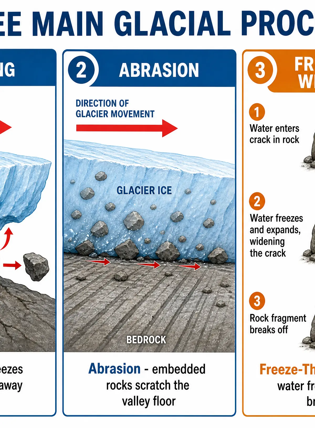
Glacial Erosion
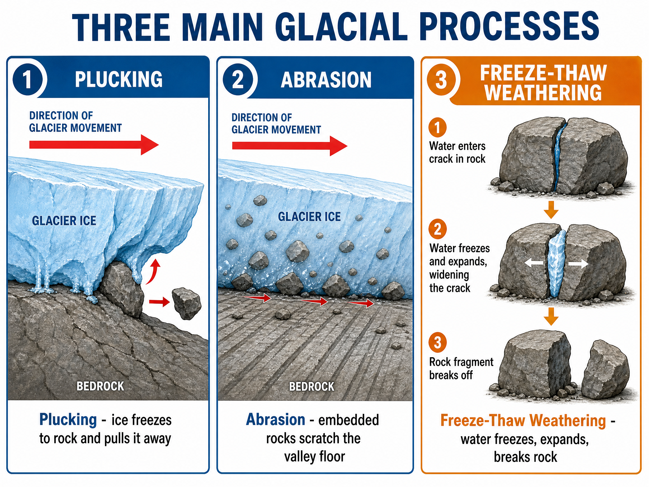
Plucking: This occurs when meltwater at the base of a glacier freezes onto the underlying bedrock. As the glacier moves forward, it literally 'plucks' or pulls chunks of rock away. This process leaves a jagged, uneven surface.
Abrasion: This is the 'sandpaper' effect. Rocks and debris embedded in the base and sides of the glacier scrape against the bedrock as the glacier moves. This process creates a smooth, polished surface, often leaving deep scratches called striations.
Post-Glacial Weathering
Freeze-Thaw Weathering (Mechanical): Water enters cracks in exposed rock. When temperatures drop below freezing (often overnight), the water turns to ice and expands by about 9%. This exerts immense pressure on the rock, widening the crack. Repeated cycles of freezing and thawing eventually cause fragments of rock (scree) to break off.
Glacial Landforms
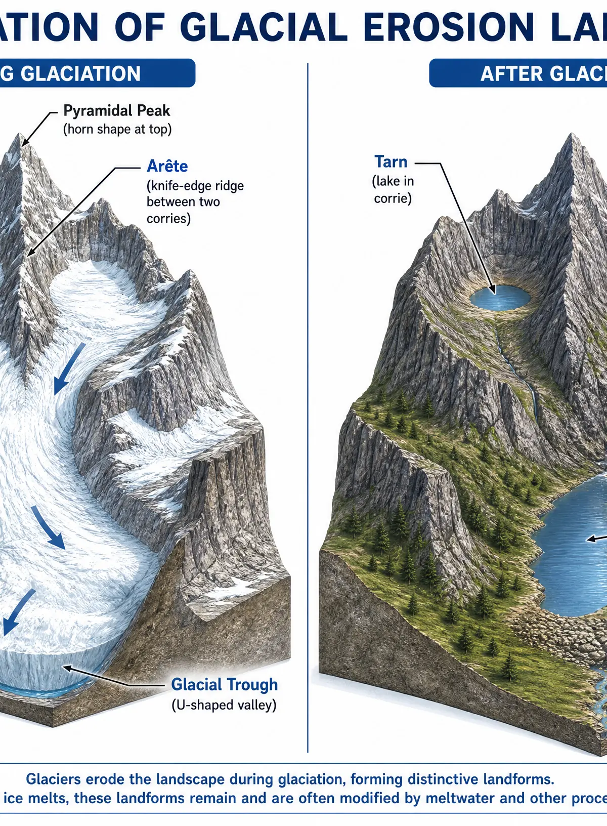
Erosion Landforms
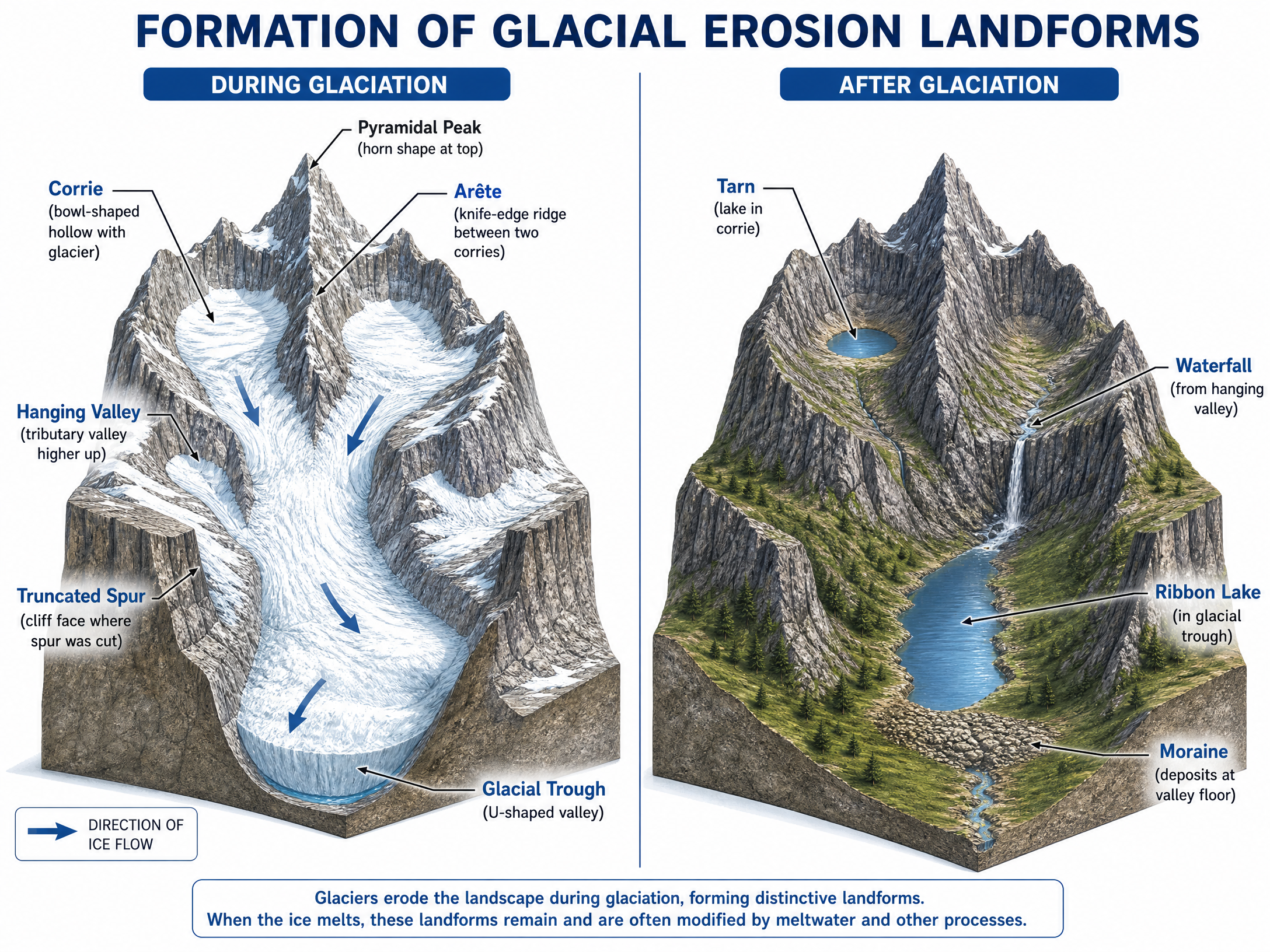
- Corrie (Cirque/Cwm): A steep-sided, armchair-shaped hollow on a mountainside. Formed as snow accumulates, compacts into ice, and moves in a rotational manner, deepening the hollow through plucking and abrasion. When the ice melts, a circular lake called a tarn often remains.
- Arête: A sharp, knife-edge ridge formed when two corries erode back-to-back towards each other.
- Pyramidal Peak: A sharply pointed mountain peak formed when three or more corries erode backwards into the same mountain.
- Glacial Trough: A deep, steep-sided, wide, flat-bottomed U-shaped valley. Glaciers bulldoze through pre-existing V-shaped river valleys, eroding the sides and floor to create the characteristic U-shape.
- Truncated Spurs: Interlocking spurs of a river valley that have been 'chopped off' (truncated) by the powerful glacier as it moved straight down the valley.
- Hanging Valley: A smaller tributary valley left 'hanging' high above the main glacial trough floor. Tributary glaciers were smaller and had less erosive power than the main glacier. They often feature spectacular waterfalls.
Deposition Landforms
- Moraine: Unsorted, angular glacial deposits (till/boulder clay). Ground moraine is material dragged beneath the glacier and left on the valley floor. Terminal moraine is a ridge of material deposited at the glacier's snout (front), marking its maximum advance.
- Drumlin: A smooth, elongated, egg-shaped hill of deposited till. The steep 'stoss' end faces the direction the ice came from, while the gentle 'lee' slope points in the direction of ice movement.
Human Activities and Their Impacts
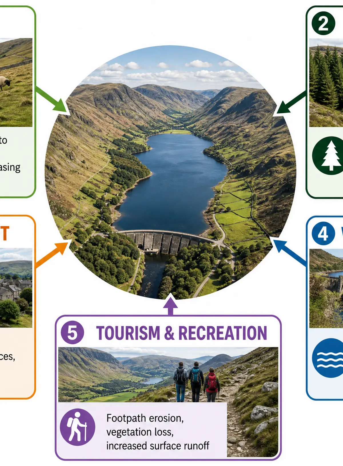
Human activities in glaciated uplands have significant impacts on the physical landscape and processes.
Farming
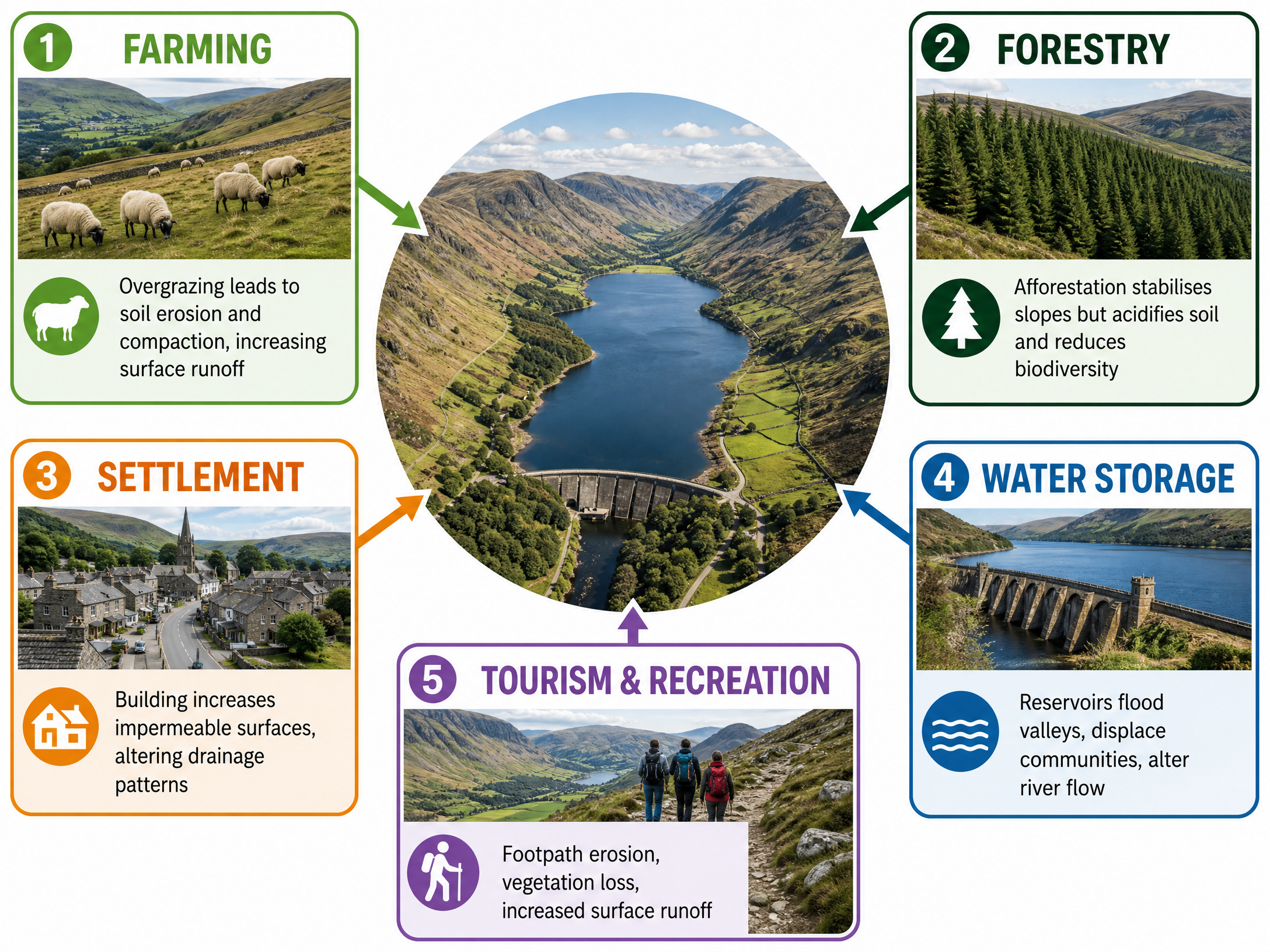
Sheep farming is common due to steep slopes and poor soils. Impact: Overgrazing removes vegetation cover, leading to soil compaction from hooves. This reduces infiltration, increases surface runoff, and accelerates soil erosion.
Forestry
Large areas are planted with coniferous trees (afforestation). Impact: While tree roots stabilise soils and reduce mass movement, dense plantations intercept rainfall, reducing water reaching the ground. The needles acidify the soil and reduce biodiversity.
Settlement and Development
Villages are often built on the flat floors of glacial troughs. Impact: Constructing buildings and roads increases impermeable surfaces. This alters local drainage patterns, increases rapid surface runoff, and raises the risk of flooding in the valley bottom.
Water Storage
Glacial troughs, with their steep sides, high rainfall, and impermeable rock, are ideal for reservoirs. Impact: Dam construction floods the valley, permanently altering the landscape, displacing local communities, and disrupting natural river flow and sediment transport downstream.
Tourism and Recreation
Areas like the Lake District attract millions of visitors for hiking and sightseeing. Impact: High footfall causes severe footpath erosion, destroying vegetation. This exposes bare soil to heavy rainfall, leading to deep gullies and increased sediment washing into tarns and ribbon lakes.
Case Study: The Lake District (Borrowdale)
Location: Cumbria, North West England.
Geology: Formed largely of resistant Borrowdale Volcanic rocks, which allowed dramatic erosion features like the steep crags and deep troughs to form and persist.
Significance of Location: High altitude and westerly location mean it receives high orographic rainfall, powering streams and post-glacial weathering processes. Its proximity to major urban centres (Manchester, Liverpool) makes it a prime target for tourism and water supply (e.g., Thirlmere reservoir).
Visual Resources
3 diagrams and illustrations
Interactive Diagrams
1 interactive diagram to visualise key concepts
Conceptual Flow Outline
Flowchart showing the sequential formation of a Corrie.
Worked Examples
3 worked examples — open one to explore the question and available guidance.
Practice Questions
Test your understanding — click to reveal model answers
Explain how freeze-thaw weathering modifies glaciated upland landscapes today. (4 marks)
Hint: Focus on the mechanism of water freezing and expanding, and what happens to the rock as a result.
For a named glaciated upland landscape in the UK, explain why its location is significant for human activity. (6 marks)
Hint: Think about climate (rainfall), geology (impermeable rock), and proximity to urban areas.