Pearson Edexcel · GCSE · Geography
Human activities can lead to changes in glaciated upland landscapes
This study guide explores how human activities shape and transform glaciated upland landscapes like the Lake District. It covers the crucial exam topics of farming, forestry, and tourism, providing the specific examples and balanced evaluations examiners look for.
- 6 min read
- 2 worked examples
- 2 practice questions
- 6 key terms
Study Notes
Overview
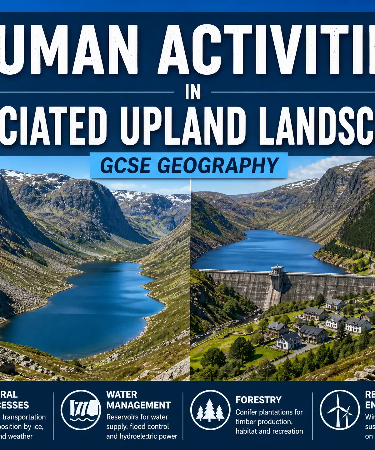
Glaciated upland landscapes, such as the Lake District, Snowdonia, and the Scottish Highlands, were carved by ice during the last glacial period, which ended approximately 10,000 years ago. However, these environments are not static; they are continuously modified by human activities. For your GCSE Geography exam, examiners expect you to understand how human interventions—including farming, forestry, settlement, water management, renewable energy, and tourism—impact the physical processes of these landscapes. You must be able to link human actions (like overgrazing) to physical consequences (like increased soil erosion) and evaluate the advantages and disadvantages of major developments using specific named examples.
<audio controls src="">Your browser does not support the audio element.</audio>
Key Human Activities and Impacts
Farming
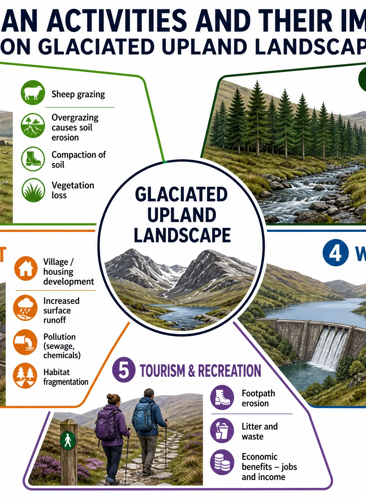
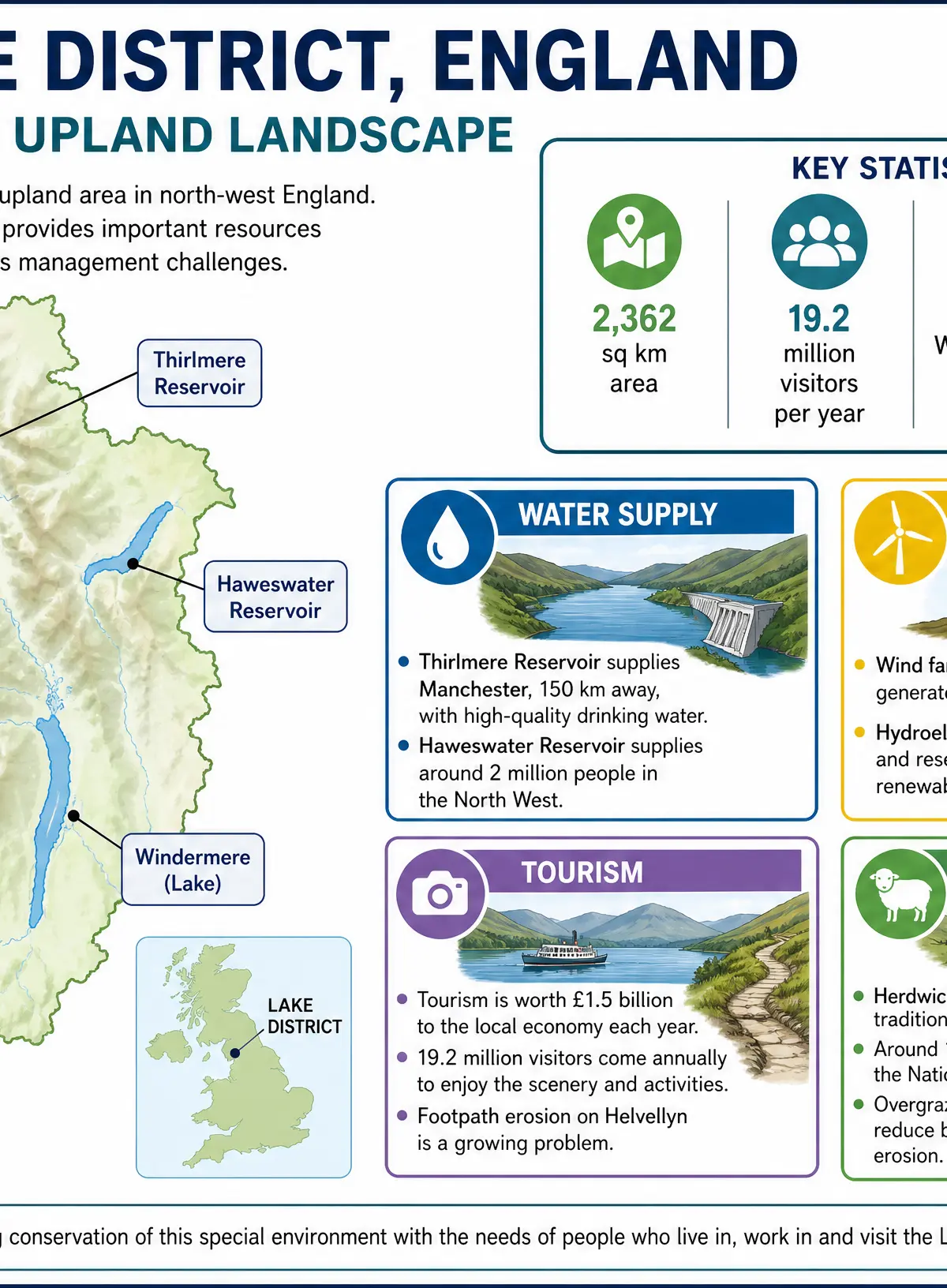
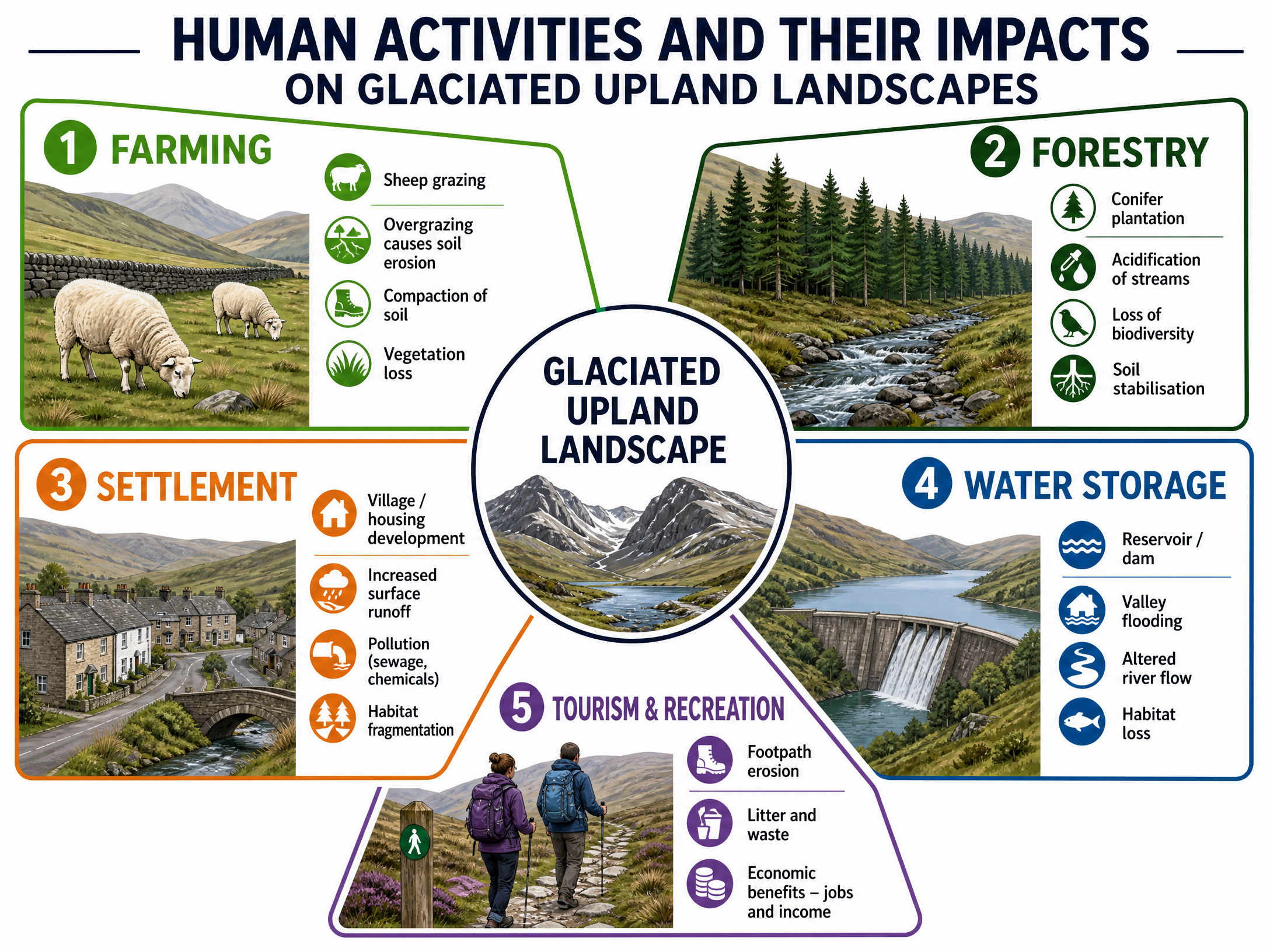
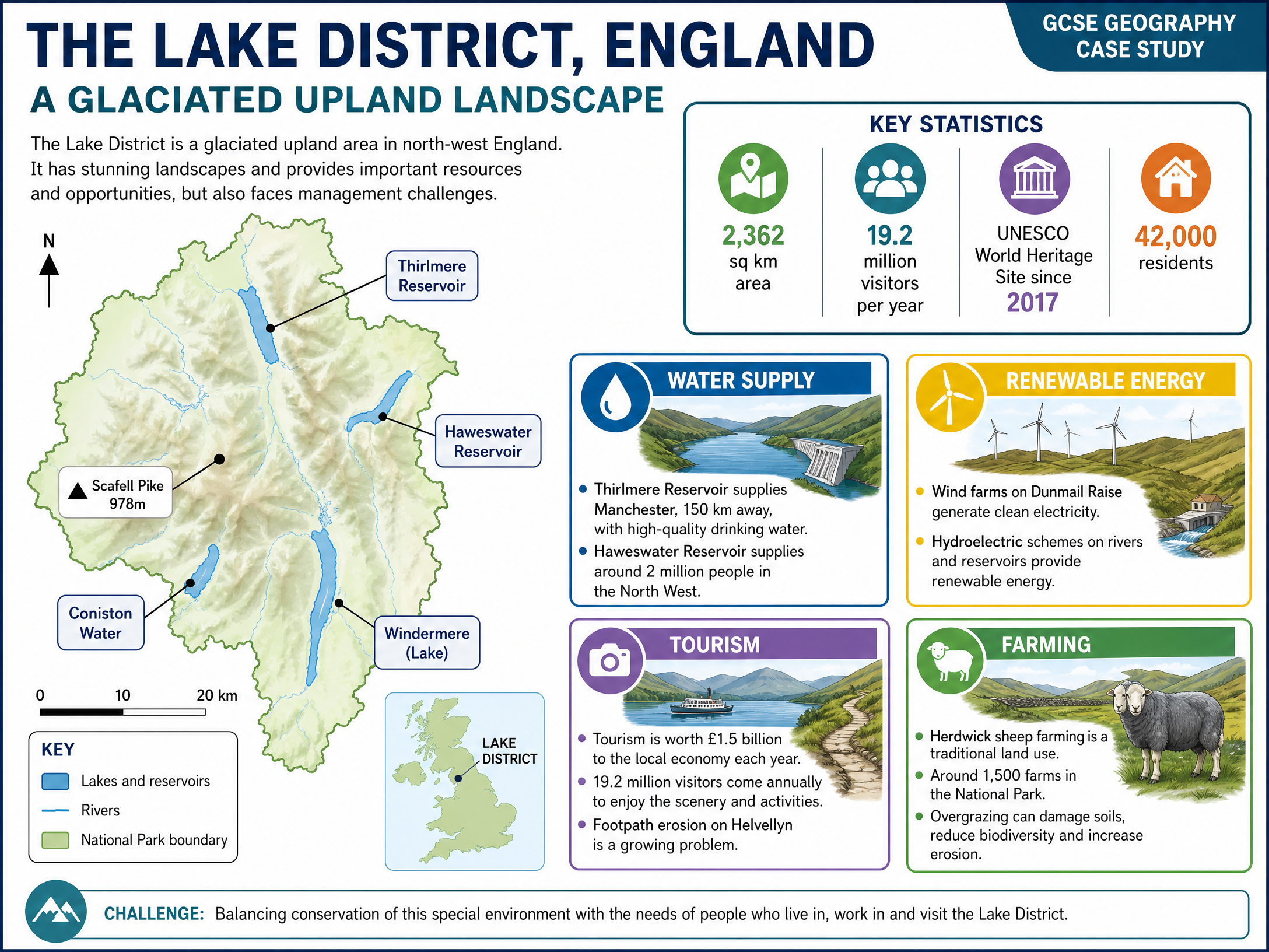
Activity: Pastoral farming (sheep rearing) is the dominant agricultural activity due to steep slopes, poor soils, and harsh climates. In the Lake District, Herdwick sheep are a traditional breed adapted to these conditions, with around 1,500 farms operating in the National Park.
Impact on Physical Processes:
- Overgrazing: When too many sheep graze, vegetation is stripped away. This exposes the thin upland soils to heavy rainfall, leading to severe soil erosion.
- Compaction: Animal trampling compacts the soil, reducing infiltration and increasing surface runoff, which alters the valley's hydrological cycle and increases flood risk downstream.
Forestry
Activity: Large areas of glaciated uplands have been planted with coniferous forests (e.g., Sitka spruce) by organisations like the Forestry Commission for commercial timber.
Impact on Physical Processes:
- Soil Stabilisation: Tree roots help bind the soil, reducing erosion on steep slopes.
- Acidification: Decomposing conifer needles acidify the soil and streams, harming aquatic ecosystems.
- Biodiversity Loss: Dense, dark conifer plantations support far less wildlife than native broadleaf woodlands.
Settlement
Activity: Villages and towns (e.g., Keswick, Ambleside) have developed primarily on the flatter valley floors.
Impact on Physical Processes:
- Impermeable Surfaces: Tarmac and concrete reduce infiltration, increasing rapid surface runoff and the risk of flash flooding.
- Pollution: Localised pollution from domestic waste and sewage can affect water quality in ribbon lakes and streams.
Major Developments: Advantages and Disadvantages
Water Storage and Supply
Glaciated U-shaped valleys are ideal for reservoirs due to their deep, steep-sided profiles and the high rainfall of upland areas.
Case Study: Thirlmere and Haweswater Reservoirs
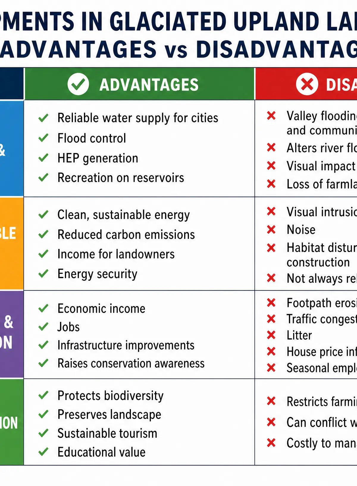
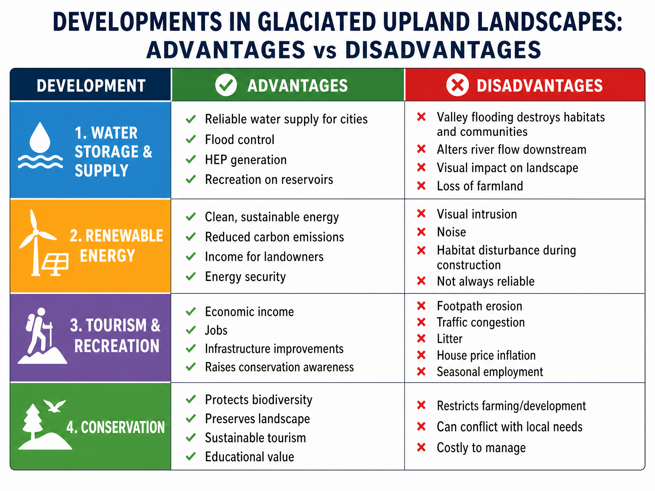
- Advantages: Provides a reliable, clean water supply to major urban areas (Thirlmere supplies Manchester via a 150km aqueduct; Haweswater supplies around 2 million people). Reservoirs also offer opportunities for recreation (sailing, fishing) and hydroelectric power generation.
- Disadvantages: Creating a reservoir requires flooding the valley floor, which destroys habitats, farmland, and sometimes entire communities (e.g., the village of Mardale Green was submerged for Haweswater in the 1930s). Dams also alter the natural flow of rivers downstream, disrupting ecosystems.
Renewable Energy
Exposed, high-altitude ridges are ideal for wind farms, while steep gradients and high rainfall suit hydroelectric power (HEP).
Case Study: Wind Farms in Upland Britain
- Advantages: Generates clean, sustainable electricity, reducing reliance on fossil fuels and cutting carbon emissions. Provides vital income for local landowners and farmers who lease their land.
- Disadvantages: Severe visual intrusion on areas of outstanding natural beauty, which can negatively impact tourism. Construction requires access roads that disturb fragile upland habitats and peat bogs.
Tourism and Recreation
Case Study: The Lake District National Park
- Advantages: Huge economic benefits—tourism brings 19.2 million visitors annually, generating £1.5 billion for the local economy. This supports thousands of jobs in hotels, outdoor centres, and retail, and funds conservation efforts.
- Disadvantages: Severe footpath erosion on popular routes (e.g., Helvellyn and Scafell Pike), widening paths and exposing bare rock. Traffic congestion on narrow valley roads, air pollution, and litter. High demand for holiday homes prices local people out of the housing market.
Conservation
National Parks aim to balance human use with environmental protection.
- Advantages: Protects biodiversity, restores damaged landscapes (e.g., stone-pitching eroded footpaths), and ensures the area remains attractive for sustainable tourism.
- Disadvantages: Conservation regulations can restrict farming practices and limit new infrastructure or housing development, sometimes causing conflict with local residents who need affordable homes and jobs.
Source Skills
When evaluating sources (like OS maps, photographs, or GIS data) showing human impacts in glaciated areas:
- OS Maps (1:25000 / 1:50000): Look for contour lines to identify steep slopes where forestry or reservoirs are located. Spot symbols for viewpoints, car parks, and footpaths to identify tourism hotspots.
- Photographs: Look for evidence of footpath erosion (bare earth, widened tracks), the straight edges of conifer plantations, or the visual impact of wind turbines against the skyline.
Visual Resources
3 diagrams and illustrations
Interactive Diagrams
1 interactive diagram to visualise key concepts
Conceptual Flow Outline
The process of footpath erosion caused by tourism.
Worked Examples
2 worked examples — open one to explore the question and available guidance.
Practice Questions
Test your understanding — click to reveal model answers
Using a named example, evaluate the impacts of tourism in a glaciated upland area. (9 marks)
Hint: Ensure you cover both positive (economic) and negative (environmental/social) impacts, use specific facts about your chosen area, and reach a conclusion.
Explain two ways that renewable energy developments can cause conflict in glaciated upland areas. (4 marks)
Hint: Identify the groups of people who might disagree about wind farms, and explain why their views clash.